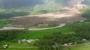
New map data and 1.6 million paper maps will contribute to less damage to the environment and communities during the giant NATO exercise, Trident Juncture.
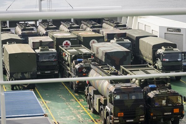
When 40,000 soldiers from 31 countries are practicing with 10,000 vehicles,it presents challenges in several ways. In nature, tracks can last for a long time,and damage can be done permanently. In addition, there are other areas to be protected, such as schools, hospitals, cultural monuments and drinking water sources.
To help the soldiers avoid mistakes, the Mapping and Armed Forces divisions have collaborated to produce 1.6 million paper maps, a map pile weighing around 100 tons, the Mapping Authority wrote in a press release.
“Updated maps are, alfa and omega, designed to plan to ensure that the environment is safeguarded,” said Nils Flakstad, Head of Department at the Mapping Authority.
“Maps are priceless as harm prevention measures and will be a very important aid for us during the exercise,” said environmental officer, Marianne Bø, at the Armed Forces operating headquarters. She leads the damage prevention and environmental protection group during the exercise.
The countries participating in the exercise have, in addition to the paper maps,also received map data sets with a new coding that is common to the alliance,and will be Norway’s first use.
© NTB scanpix / #Norway Today